Hertfordshire
Historic county north of London, home to Roman ruins and film studios.

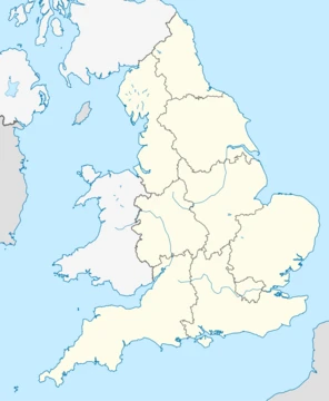
Hertfordshire is a ceremonial county in the East of England, often abbreviated Herts. It borders Bedfordshire, Cambridgeshire, Essex, Greater London, and Buckinghamshire, with Watford as its largest settlement.
- largest_settlement
- Watford
- county_town
- Hertford
- ceremonial_county
- East of England
- notable_landmarks
- Six Hills, Verulamium, Leavesden Film Studios, Hatfield House
Lore & Background
Hertfordshire shows evidence of human life from the Mesolithic period, with farming in the Neolithic and permanent habitation by the Bronze Age. Saint Alban, a Romano-British soldier, was beheaded on Holywell Hill, and his cross is reflected in the county's flag and coat of arms. After the Romans left in the early 5th century, Anglo-Saxons invaded, and by the 6th century most of the modern county was part of the Kingdom of Essex, later losing territory to Mercia. The region became an English shire in the 10th century on the merger of West Saxon and Mercian kingdoms. The county suffered renewed Norse raids in the late 10th to early 11th centuries under Swein Forkbeard and Cnut the Great.
Reader's Guide
Hertfordshire's significance lies in its layered history and modern innovations. It contains Roman remains at Verulamium, medieval and Tudor buildings that surpass London in volume, and sites linked to the drafting of Magna Carta at St Albans Abbey. The county was a stage for two battles in the Wars of the Roses and later a retreat for Tudor and Stuart royalty, with Hatfield House visited by Queen Elizabeth I and the New River built under James I to supply London with water. Its economy shifted to services, and it became a hub for film and television production, including Leavesden Film Studios (Harry Potter series, GoldenEye) and Elstree/Borehamwood studios (Star Wars, EastEnders). Its geography includes the Chilterns, the rivers Lea and Colne, and much of the Metropolitan green belt.
Did You Know?
- The first shooting-down of a zeppelin over Great Britain during WW1 happened in Cuffley, Hertfordshire.
- The Domesday Book recorded Hertfordshire as having nine hundreds, including Dacorum from 'Danis Corum' meaning Danish rule.
A Four-Century Sheriffdom Shared with Essex
This was not an isolated arrangement; across England in the post-Conquest era, numerous county pairs or groups shared a sheriff for varying stretches of time, some lasting centuries. The Essex–Hertfordshire pairing sat among these long-standing administrative unions, reflecting a period when local governance was far more consolidated than modern readers might expect. For Hertfordshire, those four centuries of shared judicial and administrative oversight with its eastern neighbour shaped a regional identity that outlasted the specific institutional mechanism that created it.
The South East Economic Planning Region of 1964
Hertfordshire was placed within the South East grouping, a region that also encompassed Bedfordshire, Berkshire, Buckinghamshire, Essex, Greater London, Hampshire, Kent, Oxfordshire, Surrey, and Sussex. This was one of eight such regions stretching from the Northern region in the far north—covering Cumberland, Durham, the North Riding of Yorkshire, Northumberland, and Westmorland—to the South West in the opposite corner. The South East's composition, bundling Hertfordshire together with London and a wide arc of home counties and southern shires, reflected a pragmatic grouping for planning purposes rather than any single cultural or historical identity. The region's boundaries drew on existing county lines, creating a broad swath of England's most densely populated and economically active territory under one administrative umbrella.
From Statistical Regions to Government Office Regions
Before the Government Office Regions were formally created in 1994 and subsequently adopted for statistical purposes in 1999, England relied on a set of eight standard statistical regions. In that earlier scheme, Hertfordshire belonged to the South East, a grouping that also included Greater London, Bedfordshire, and Essex. The introduction of the new government office structure rendered some of these older statistical arrangements obsolete, yet the transition did not eliminate the broader landscape of alternative regional designations that continued to be widely used across the country. The shift from the standard statistical framework to the government office model represented a reorganisation of how data and policy were mapped onto the geography, with Hertfordshire's placement shifting as the underlying administrative logic changed. For statisticians and policymakers alike, the 1994 and 1999 milestones marked the point at which the older eight-region statistical map gave way to a new set of boundaries, even as cultural and informal regional labels persisted alongside the official ones.
Hertfordshire Within England's Layered Regional Identity
England's geography is described through a remarkable density of overlapping regional schemes, and Hertfordshire sits within this layered web. Beyond official administrative boundaries, the country is rich in informal cultural designations—ranging from the Midlands and Black Country to the Home Counties, the M4 corridor, and the Thames Valley—each carrying its own connotations. The ancient Heptarchy kingdoms of Northumbria, Mercia, East Anglia, Essex, Kent, Sussex, and Wessex continue to be recognised by organisations as regional identifiers, even though they predate modern counties by centuries. Other frameworks include the twelve regions used by Britain in Bloom, the ten regional offices of the National Trust, and postcode areas that sometimes approximate geographic terminology where administrative borders differ. Hertfordshire, though a single county, has been absorbed into each of these competing and complementary schemes, its identity shifting depending on which lens—economic, cultural, statistical, or historical—is applied.
Frequently Asked Questions
Who is Hertfordshire?
Hertfordshire is a ceremonial county in the East of England, often shortened to 'Herts,' with Hertford serving as its county town and Watford as its largest settlement. It sits immediately north of Greater London and shares borders with Bedfordshire, Cambridgeshire, Essex, and Buckinghamshire.
More in Regions Of England 1-18
Spotted an error? Know more?
This is a living reference — every entry is fact-audited, and reader corrections feed straight into our audit queue. Suggest an edit · See this site's audit record