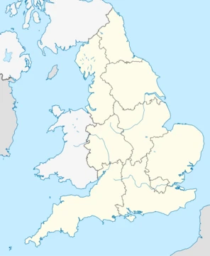
Gloucestershire
Ceremonial county in South West England, bisected by the River Severn.

Gloucestershire is a ceremonial county in South West England, bordered by Herefordshire, Worcestershire, Warwickshire, Oxfordshire, Wiltshire, Bristol, Somerset, and the Welsh county of Monmouthshire. Its largest settlement is the city of Gloucester. Gloucestershire is bisected by the River Severn and contains the Cotswolds, the Forest of Dean, and the Wye Valley, all designated national landscapes.
- established
- 10th century
- largest_settlement
- Gloucester
- county_town
- Gloucester
- ceremonial_county_flag_adopted
- March 2008
Lore & Background
Gloucestershire was likely established in the tenth century and expanded to approximately its current borders in the eleventh. The county was relatively settled during the late Middle Ages and contained wealthy monasteries such as Tewkesbury, Gloucester, Hailes, and Cirencester. The Forest of Dean was a major iron-producing region in this period. Gloucestershire was not heavily industrialised during the Industrial Revolution, but the Port of Gloucester was expanded with new docks and the small Forest of Dean coalfield was exploited. In July 2007, Gloucestershire was subject to some of the worst flooding in recorded British history, with tens of thousands of residents affected. Damage was estimated at over £2 billion. In March 2008, the ceremonial county adopted a flag through a contest judged by the High Sheriff of Gloucestershire, Jonathan Carr. For local government purposes, Gloucestershire comprises a non-metropolitan county with six districts and the unitary authority area of South Gloucestershire.
Reader's Guide
Gloucestershire's significance lies in its long history as a historic county mentioned in the Anglo-Saxon Chronicle in the 10th century, its role in medieval monastic wealth and iron production, and its modern administrative evolution. The county's geography features three main landscape areas: the Cotswolds, the Forest of Dean, and the Severn Vale. The 2007 floods were a major disaster, prompting a large-scale RAF rescue operation. Gloucestershire's legacy includes its rural character, historic towns like Cheltenham and Tewkesbury, and its role in the West of England Combined Authority through South Gloucestershire.
Did You Know?
- Gloucestershire was likely established in the tenth century and expanded to approximately its current borders in the eleventh.
- The county was subject to some of the worst flooding in recorded British history in July 2007, with damage estimated at over £2 billion.
Origins & Government Backing
Under this arrangement, the private sector would contribute 20% of the funding, while the government and the local authorities of Bristol and South Gloucestershire would cover the remainder. Public appetite for such a system had been building for years, fueled by consistent opinion polls identifying inadequate transport and traffic congestion as top local concerns.
Route Design & Ambition
Line One was the centerpiece of the Supertram vision: a 10-mile corridor from Bristol City Centre to Almondsbury, designed to complete the journey in 30 minutes with 16 intermediate stops. The route would have begun at a terminus on Union Street near the bus station, threading through Quay Street, Prince Street, and St Mary Redcliffe before connecting with the National Rail network at Temple Meads. Entering South Gloucestershire, the line would pause at Filton Abbey Wood and Bristol Parkway before departing the existing rail infrastructure onto purpose-built track. A park-and-ride at Parkway North would link to the M4, three stops would traverse the Bradley Stoke residential area, and the northern terminus at Aztec West business park would provide M5 access. Four further routes were sketched for future phases, including links to Yate via Emersons Green, the Portishead Railway, and the Severn Beach line.
The Council Dispute & Collapse
The project's undoing began with a fundamental disagreement between the two partner councils. South Gloucestershire proposed extending Line One to The Mall shopping centre at Cribbs Causeway, while Bristol favoured the original Aztec West terminus. With that proposal rejected, South Gloucestershire council withdrew entirely from the Supertram. Bristol City Council then submitted a modified route in late 2003, terminating at Parkway station, and a government feasibility study was launched to reassess funding eligibility. However, the council simultaneously faced political pressure to curb a proposed council tax increase. Weighed down by financial strain and mounting uncertainty, both the Labour and Conservative groups on the council recommended abandonment. In March 2004, Bristol officially cancelled the project, redirecting the ring-fenced funds toward covering the tax rise.
Legacy & The Push for Regional Integration
Even after the 2004 cancellation, the Supertram's ghost continued to shape transport policy debates across the Bristol region. From at least 2009, advocates have argued that the four unitary authorities—Bristol, South Gloucestershire, North Somerset, and Bath and North East Somerset—should establish a regional Integrated Transport Authority. The rationale was straightforward: a unified body would wield greater decision-making power over local transport needs and, crucially, prevent the kind of inter-council rivalry that had fatally divided the Supertram project. Various attempts were made within the region to push for the creation of such an authority, but as of 2009 these proposals had been rejected. Nevertheless, the episode left a lasting imprint. The Supertram demonstrated both the genuine public demand for better cross-boundary transit and the structural fragility of a project dependent on multiple local authorities aligning their priorities. Subsequent local proposals to revive light rail or explore alternative transport schemes for the corridor have repeatedly referenced the lessons of the original scheme, keeping the conversation alive long after the rails were never laid.
Frequently Asked Questions
Who is Gloucestershire?
Gloucestershire is a ceremonial county in South West England whose origins trace back to the 10th century. Its county town and largest settlement is the city of Gloucester, and it sits at a crossroads bordered by eight other regions including the Welsh county of Monmouthshire.
Why is Gloucestershire important?
It anchors the South West England region and serves as a corridor linking the Midlands, the Welsh Marches, and the Bristol Channel. Its three national landscapes make it one of the most geographically diverse ceremonial counties in the country.
What is Gloucestershire's flag, and when was it adopted?
The ceremonial county flag was officially adopted in March 2008, giving the region a modern heraldic identity. It represents the county's long history as a distinct administrative and cultural entity.
More in Regions Of England 1-18
Spotted an error? Know more?
This is a living reference — every entry is fact-audited, and reader corrections feed straight into our audit queue. Suggest an edit · See this site's audit record