East Riding of Yorkshire
A historic county in Yorkshire and the Humber region of England.

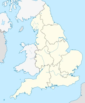
The East Riding of Yorkshire, often abbreviated to the East Riding or East Yorkshire, is a ceremonial county in the Yorkshire and the Humber region of England. It borders North Yorkshire to the north and west, South Yorkshire to the south-west, and Lincolnshire to the south across the Humber Estuary. The city of Kingston upon Hull is the largest settlement. It takes its name from the East Riding, a historic subdivision of Yorkshire.
- Largest settlement
- Kingston upon Hull
- Ceremonial county region
- Yorkshire and the Humber
- Governance
- Two unitary authorities: East Riding of Yorkshire Council and Hull City Council
- Historic origin
- East Riding of Yorkshire
Lore & Background
The area has been inhabited since the Palaeolithic period, when hunter-gatherers followed animal herds across the land between continental Europe and Britain. By the Mesolithic period, communities became more fixed to particular localities, and in the Great Wold Valley, pollen samples indicate that forest cover was being disturbed and open grasslands created. In the Iron Age, the Arras Culture emerged, named after a site near Market Weighton, with chariot burials similar to those in northern Europe.
Reader's Guide
The East Riding of Yorkshire holds significance as a region with a deep and layered history, from prehistoric hunter-gatherers through the Roman, Anglo-Saxon, and Viking periods. Its landscape—the chalk Yorkshire Wolds, the low-lying plain of Holderness, and the Vale of York—shaped settlement and agriculture. The area was the kingdom of the Parisi tribe, invaded by the Romans in AD 71, and later became part of Deira and Northumbria. Danish settlement in the 9th century left lasting place-name elements such as -by and -thorpe. After the Norman Conquest, the Harrying of the North devastated many villages, and land was granted to barons and ecclesiastical institutions. The dissolution of the monasteries under Henry VIII led to large landholdings being sold into private ownership, some persisting into the 20th century. Today, the county is governed by two unitary authorities and remains a mix of the urban port of Kingston upon Hull and rural areas including Bridlington and Beverley.
Did You Know?
- The East Riding of Yorkshire takes its name from the East Riding, a historic subdivision of Yorkshire.
- The Arras Culture, named after a site near Market Weighton, practiced chariot burials similar to those in northern Europe.
- The county's coastline includes the chalk headland of Flamborough Head and the clay cliffs of Holderness.
Historic County and Cultural Identity
The East Riding of Yorkshire occupies a distinctive position in England's layered system of regional designations. It is explicitly catalogued as a historic county, listed in the same breath as the North Riding and West Riding of Yorkshire, Sussex, and Middlesex—names that persist as alternative regional labels even though they no longer function as primary administrative boundaries. Beyond its county status, the broader Yorkshire identity is recognised as one of the informal, overlapping cultural designations employed to characterise areas of England. These cultural labels, which also include the Midlands, the Black Country, the Welsh Marches, and the West Country, are noted for their fluidity and frequent interchangeability with other terms. The East Riding thus exists at the intersection of a specific historic county identity and a wider, more loosely defined cultural region, both of which remain in active circulation despite the proliferation of more formal administrative schemes.
The 1964 Economic Planning Framework
The East Riding of Yorkshire was assigned to the Yorkshire and Humberside grouping, which also encompassed the West Riding of Yorkshire, the county of Lincolnshire, and the Parts of Lindsey. This pairing of the two Yorkshire Ridings with Lincolnshire and its Parts created a regional unit that crossed traditional county lines, reflecting the practical need for economic coordination across adjacent areas. The eight regions named by Brown—spanning from Northern, which included Cumberland, Durham, the North Riding of Yorkshire, Northumberland, and Westmorland, all the way to East Anglia—represented a comprehensive attempt to map England into manageable planning zones. The East Riding's inclusion in this particular grouping underscores how administrative boundaries have often been drawn to serve economic logic rather than to follow historic county divisions, even when those divisions, like the three Yorkshire Ridings, carry deep cultural resonance.
Statistical Regions and the 1994 Reforms
Before the Government Office Regions were created in 1994 and subsequently adopted for statistical purposes in 1999, England was divided into eight standard statistical regions. The East Riding of Yorkshire fell within the Yorkshire and Humberside statistical region, which corresponded to what is now called Yorkshire and the Humber. The introduction of the new government office framework rendered some of these earlier statistical schemes obsolete, yet the source material notes that many alternative regional designations remain in active circulation alongside the formal structures. The coexistence of these layers illustrates a broader pattern in English regional administration, where no single scheme has fully displaced its predecessors, and where the East Riding's identity is perpetually negotiated across competing administrative and statistical vocabularies.
Institutional Coverage and Overlapping Schemes
The East Riding of Yorkshire is touched by multiple institutional and organisational frameworks that each impose their own regional logic. The National Trust, for instance, operates ten regional offices across England, and its North East England office is responsible for both North East England and Yorkshire and the Humber—meaning the East Riding falls under a single Trust office shared with a neighbouring government region. Separately, the Britain in Bloom initiative divides England into twelve regions, described as a mixture of government regions with some altered names, and includes areas like Cumbria and Thames-and-Chilterns alongside conventional designations. The East Riding thus sits within a patchwork of overlapping institutional geographies: a historic county, a cultural region, an economic planning zone, a statistical region, a government office region, a National Trust office area, and a Britain in Bloom region. Each of these schemes serves a different purpose—heritage, economics, statistics, conservation, horticultural competition—yet all claim the same territory, creating a rich but complex web of regional identity.
Frequently Asked Questions
How does East Riding of Yorkshire's story end?
Because it is a living administrative and geographic entity rather than a fictional narrative, East Riding of Yorkshire has no fixed conclusion; it simply continues to exist as part of England's local government structure. Its ongoing 'arc' is shaped by the decisions of its two unitary councils and its evolving role within the Yorkshire and the Humber region.
Why is East Riding of Yorkshire important?
The county forms a vital coastal and industrial corridor in northern England, with Kingston upon Hull serving as a major port and cultural centre. Its position straddling the Humber Estuary and bordering three other counties makes it a geographic and economic crossroads in the region.
Where does East Riding of Yorkshire sit relative to its neighbours?
It occupies the eastern flank of Yorkshire, touching North Yorkshire to the north and west, South Yorkshire to the south-west, and Lincolnshire to the south across the Humber Estuary. This places it squarely within the Yorkshire and the Humber region of England.
More in Regions Of England 1-18
Spotted an error? Know more?
This is a living reference — every entry is fact-audited, and reader corrections feed straight into our audit queue. Suggest an edit · See this site's audit record