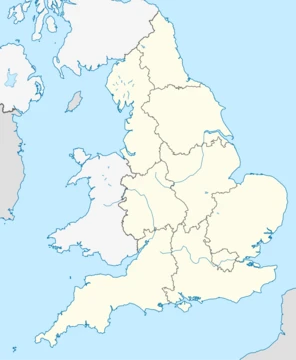
Cumbria
Ceremonial county in North West England, home to the Lake District.

Cumbria is a ceremonial county in North West England, created in 1974 from the historic counties of Cumberland and Westmorland, the Furness area of Lancashire, and a small part of Yorkshire. Its largest settlement is the city of Carlisle. The county is noted for its upland areas, including the Lake District, a national park and UNESCO World Heritage Site, which contains England's highest mountain, Scafell Pike, and its longest and largest lake, Windermere.
- largest_settlement
- Carlisle
- created
- 1974
- ceremonial_county
- North West England
- unitary_authorities
- Westmorland and Furness, Cumberland
Lore & Background
Cumbria contains several Neolithic monuments, such as Mayburgh Henge, and was on the border of Roman Britain; Hadrian's Wall runs through the north of the county. In the Early Middle Ages parts of the region successively belonged to Rheged, Northumbria, and Strathclyde, with a Viking presence. During the Industrial Revolution mining took place on the Cumberland coalfield and Barrow-in-Furness became a shipbuilding centre, but the county was not heavily industrialised.
Reader's Guide
Cumbria's significance lies in its natural landscapes and historical role as a contested border region. The county also contains the North Pennines, Yorkshire Dales, and Solway Firth national landscapes. Its history includes Neolithic stone axe production, Roman fortifications, and medieval Anglo-Scottish conflicts. In 2010, a shooting spree by taxi driver Derrick Bird killed 12 people along the Cumbrian coastline.
Did You Know?
- Cumbria was created in 1974 from Cumberland, Westmorland, part of Lancashire, and a small part of Yorkshire.
- The Lake District includes England's highest mountain, Scafell Pike, and its deepest lake, Wast Water.
- Hadrian's Wall, a UNESCO World Heritage Site, runs through northern Cumbria.
Shifting Boundaries: Cumbria's Administrative Identity
Cumbria has never enjoyed a single, fixed place within England's patchwork of regional schemes. A few years later, the standard statistical regions treated the area differently still: the 'North' region absorbed Cumbria alongside the current North East, while the 'North West' region was explicitly defined as the current North West minus Cumbria. This oscillation between northern groupings reflects a broader pattern in which England's regional boundaries have been redrawn repeatedly for different purposes. The creation of Government Office Regions in 1994, later adopted for statistical use in 1999, further reshuffled the deck, rendering some older schemes obsolete while others persisted in popular usage. For Cumbria, the result has been a regional identity that is as much a matter of administrative convention as of geography.
Cumbria Among England's Many Regional Names
England is a land of layered, overlapping regional names, and Cumbria sits within a dense web of them. Informal cultural designations such as the Midlands (often treated as synonymous with Mercia), the West Country (frequently equated with Wessex), Yorkshire, and the Home Counties have long coexisted with more formal administrative divisions. The ancient Heptarchy left its mark too: Northumbria, though primarily associated with the North East and the historic counties of Northumberland and Durham, is sometimes stretched to encompass all of Northern England, a usage that can blur the boundary with Cumbria's own identity. National parks such as the Peak District, the North York Moors, and the Yorkshire Dales add yet another layer of regional recognition, while schemes like Britain in Bloom carve England into twelve areas that mix government regions with altered names. In this crowded landscape, Cumbria's name competes with a dozen other labels for the same or adjacent ground, making its regional identity a matter of which framework one happens to be consulting at any given moment.
Cumbria's Bureaucratic Life: Planning and Statistics
For much of the postwar period, Cumbria's relationship with England's bureaucratic machinery was anything but straightforward. This was a deliberately broad grouping, one that treated the area as part of a wider northern bloc rather than as a distinct entity. The standard statistical regions that followed offered a different logic: Cumbria was appended to the 'North' region, defined as the current North East plus Cumbria, while simultaneously being carved out of the 'North West,' defined as the current North West less Cumbria. This dual treatment meant that in one statistical table Cumbria belonged to the north, and in another it was explicitly excluded from the northwest. The 1994 Government Office Regions and their 1999 statistical adoption eventually provided a more stable framework, though many of these earlier designations continued to circulate in planning documents and public discourse well beyond their official expiry.
Cumbria in National Frameworks
Beyond government statistics, Cumbria appears in a variety of national frameworks that serve different purposes. Britain in Bloom, a scheme that divides England into twelve regions, includes Cumbria as a named area, blending government regions with some altered names to create a hybrid map. The National Trust maintains ten regional offices across England, with the North West England office covering the region as a whole, while other offices handle areas like Devon and Cornwall, the East of England, and the Thames and Solent. Even the postal system offers a regional fingerprint: the LA postcode area, which covers Morecambe Bay, functions as a geographic shorthand for a part of Cumbria's coastal landscape, much as the PE area denotes The Fens or the London postcodes map Inner London. These varied frameworks—charitable, postal, horticultural—each slice Cumbria differently, and together they illustrate how a single place can carry multiple administrative and cultural identities simultaneously, none of them quite the whole story.
Frequently Asked Questions
What is Cumbria's main role or claim to fame?
The county is best known for housing the Lake District, a national park and UNESCO World Heritage Site that contains both England's highest mountain, Scafell Pike, and its longest and largest lake, Windermere. It functions as one of the country's premier outdoor and nature destinations.
What is Cumbria's largest settlement?
Carlisle is the county's biggest city and serves as its principal urban centre. Administratively, Cumbria is divided into two unitary authorities: Cumberland and Westmorland and Furness.
Why is Cumbria important to England?
It shelters the Lake District, a landscape of fells, valleys, and water that draws millions of visitors each year and carries UNESCO World Heritage designation. Its upland terrain and natural heritage make it one of the most recognisable rural regions in the country.
When was Cumbria created and from what?
The county came into being in 1974 as part of a local-government reorganisation that merged Cumberland, Westmorland, the Furness area previously in Lancashire, and a small portion of Yorkshire into a single ceremonial county in North West England.
More in Regions Of England 1-18
Spotted an error? Know more?
This is a living reference — every entry is fact-audited, and reader corrections feed straight into our audit queue. Suggest an edit · See this site's audit record