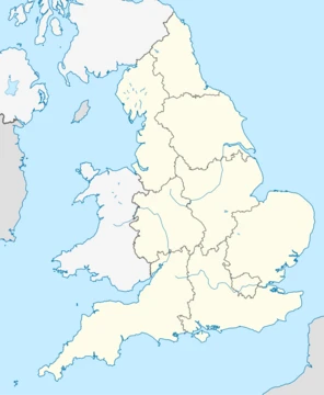
Derbyshire
Ceremonial county in the East Midlands of England.

Derbyshire is a ceremonial county in the East Midlands of England, known for its varied landscapes ranging from the uplands of the Peak District to lowlands in the south and east. It has a long history of human occupation, from Paleolithic hand axes to Roman lead mining, and remains a significant administrative and geographic region.
- Largest settlement
- Derby
- National park
- Peak District
- Furthest point from the sea in the UK
- Church Flatts Farm at Coton in the Elms
Lore & Background
Bronze Age signs of agriculture and settlement appear in the Peak District moors and at Swarkestone. During the Roman conquest, the invaders were attracted by lead ore in the limestone hills. They built forts near Brough in the Hope Valley and at Ardotalia near Glossop, and later settled around Buxton for its warm springs, establishing Derventio fort near modern-day Derby. Several kings of Mercia are buried in the Repton area. After the Norman Conquest, much of the county was subject to forest laws, with the Forest of High Peak under William Peverel and other areas granted to Henry de Ferrers, later becoming part of the Duchy of Lancaster. The county's geology is split: the north and centre have Carboniferous limestones, gritstones, sandstones, and shales, while the south has softer Permo-Triassic mudstones and sandstones. Mineralisation created lead and fluorite deposits, and coal mining was historically important. The Peak District National Park covers much of the upland area, and the county contains Church Flatts Farm, the furthest point from the sea in the UK.
Reader's Guide
Derbyshire's significance lies in its long human history, from early Paleolithic visitors through Neolithic and Bronze Age settlers, Roman exploitation of lead, and medieval forest administration. Its varied geology—Carboniferous uplands and Permo-Triassic lowlands—shaped both its landscape and economy, supporting lead mining since Roman times, coal mining, and later limestone and gravel extraction. The Peak District National Park, designated to protect the uplands, is a major natural and recreational asset. The county also contains the UK's furthest point from the sea, at Church Flatts Farm. Administratively, Derbyshire comprises a non-metropolitan county with eight districts and the Derby unitary authority, and is part of the East Midlands Combined County Authority. Its legacy includes archaeological sites such as Arbor Low and the Roman fort of Derventio Coritanorum, as well as ongoing landscape management through National Character Areas and green belts.
Did You Know?
- Derbyshire contains Church Flatts Farm at Coton in the Elms, the furthest point from the sea in the UK.
Medieval Sheriffdoms and the Binding of Counties
From the late eleventh century through the sixteenth, English counties were not always administered as isolated units. Several pairs or groups of counties shared a single sheriff for periods stretching across centuries. These arrangements reveal that the county boundaries we take for granted today were, for generations, fluid administrative conveniences rather than fixed political borders, and that neighbouring shires could function as a single jurisdiction for most of the medieval period.
Anglo-Saxon Kingdoms and Their Living Names
After the Roman withdrawal, the territory that would become England fragmented into seven major Anglo-Saxon kingdoms: Northumbria, Mercia, East Anglia, Essex, Kent, Sussex, and Wessex, alongside smaller sub-kingdoms. Remarkably, these ancient kingdom names have never fully disappeared from the landscape. Mercia is still invoked as a synonym for the Midlands; Wessex overlaps with the West Country (minus Cornwall); Northumbria remains associated with the North East; and East Anglia continues to denote Norfolk, Suffolk, and Cambridgeshire. Even Dumnonia, a Brythonic kingdom predating 500 AD in the South West, survives as a historical reference. Organisations and cultural groups continue to adopt these Heptarchy names as regional identifiers, demonstrating that political boundaries from over a millennium ago still shape how people conceptualise their geography.
Planning, Statistics, and the Splitting of Counties
The twentieth century brought repeated attempts to carve England into functional zones for economic management and data collection. Before the Government Office Regions of 1994, adopted for statistics in 1999, eight standard statistical regions served a similar purpose. Each scheme reflected the priorities of its era, and the coexistence of multiple overlapping frameworks meant that no single division ever achieved universal acceptance.
A Mosaic of Overlapping Identities
No single regional scheme dominates English life. Cultural labels such as the Black Country, the Cotswolds, the Weald, the Three Counties, and the Welsh Marches overlap with one another and with formal boundaries. National parks — the Peak District, Lake District, Dartmoor, Exmoor, North York Moors, Yorkshire Dales, South Downs, and others — create yet another layer of regional identity. The National Trust maintains ten regional offices with names like Thames and Solent and Wessex, while Britain in Bloom divides the country into twelve regions that blend government boundaries with altered names, including a combined South-and-South-West. Postcode areas sometimes serve as statistical stand-ins where administrative borders diverge from geographic reality, as with the LA area covering Morecambe Bay or the PE area for the Fens. The result is a rich, layered tapestry in which a single place can belong simultaneously to a county, a planning region, a national park, a cultural area, and a postcode zone — each framework serving a different practical or emotional purpose.
Frequently Asked Questions
Where is Derbyshire located?
It sits in the East Midlands region of England, bordered by counties including Cheshire, Staffordshire, and Nottinghamshire. The county's geography shifts noticeably from moorland high country in the north to gentler river valleys and farmland further south.
What national park is in Derbyshire?
The Peak District National Park covers a large portion of the county's northern and central areas. It is one of England's oldest designated national parks, known for its gritstone edges, deep dales, and open moorland.
What is the largest settlement in Derbyshire?
Derby is the county's principal city and its largest settlement. It functions as the main administrative, commercial, and transport hub for the wider region.
More in Regions Of England 1-18
Spotted an error? Know more?
This is a living reference — every entry is fact-audited, and reader corrections feed straight into our audit queue. Suggest an edit · See this site's audit record